Geolocate

San Angelo topographic map

Click on the map to display elevation.

About this map

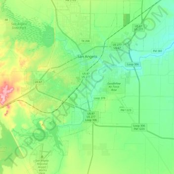
Name: San Angelo topographic map, elevation, terrain.

Location: San Angelo, Tom Green County, Texas, United States (31.33550 -100.52929 31.52649 -100.35993)

Average elevation: 576 m

Minimum elevation: 536 m

Maximum elevation: 672 m

Gear up for your next adventure:

🦶Hiking Shoe Insoles - Added support for high arches and long days on feet
🥘Camping Cookware Set - Compact nesting pots and pans for trail cooking
🧼Biodegradable Camp Soap - Environmentally friendly cleaning for gear and body
Camping Coffee Maker - Brew fresh coffee anywhere on the topographic map
🛌Insulated Sleeping Pad - Critical thermal barrier between you and the cold ground

As an Amazon Associate, this site earns from qualifying purchases at no extra cost to you.