
Baird topographic map
Interactive map
Click on the map to display elevation.
About this map
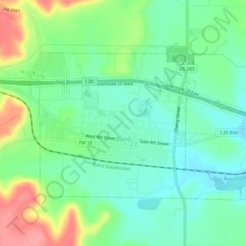
Name: Baird topographic map, elevation, terrain.
Location: Baird, Callahan County, Texas, 79504, United States (32.38510 -99.41352 32.40895 -99.36824)
Average elevation: 537 m
Minimum elevation: 506 m
Maximum elevation: 598 m
Other topographic maps
Click on a map to view its topography, its elevation and its terrain.
Clyde
United States > Texas > Callahan County
Clyde, Callahan County, Texas, United States
Average elevation: 610 m