
Belton topographic map
Interactive map
Click on the map to display elevation.
About this map
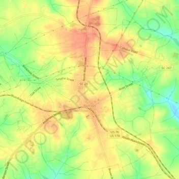
Name: Belton topographic map, elevation, terrain.
Average elevation: 257 m
Minimum elevation: 228 m
Maximum elevation: 276 m
Other topographic maps
Click on a map to view its topography, its elevation and its terrain.
Fox Valley
United States > South Carolina > Anderson County
Fox Valley, Anderson County, South Carolina, 29621, United States
Average elevation: 227 m