
Castro Daire topographic map
Interactive map
Click on the map to display elevation.
About this map
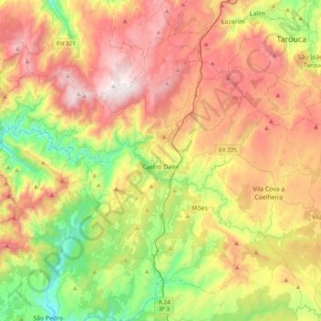
Name: Castro Daire topographic map, elevation, terrain.
Location: Castro Daire, Viseu, Portugal (40.78672 -8.13261 41.02662 -7.75008)
Average elevation: 710 m
Minimum elevation: 162 m
Maximum elevation: 1,364 m
Other topographic maps
Click on a map to view its topography, its elevation and its terrain.