
Le Bout-de-l'Île topographic map
Interactive map
Click on the map to display elevation.
About this map
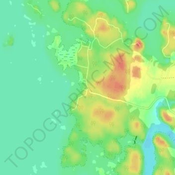
Name: Le Bout-de-l'Île topographic map, elevation, terrain.
Average elevation: 104 m
Minimum elevation: 89 m
Maximum elevation: 131 m
Other topographic maps
Click on a map to view its topography, its elevation and its terrain.
Villebois
Canada > Quebec > Lac-Saint-Jean-Est > Alma
Villebois, Alma, Lac-Saint-Jean-Est, Saguenay–Lac-Saint-Jean, Quebec, G8C 1C4, Canada
Average elevation: 117 m