
Atherley topographic map
Interactive map
Click on the map to display elevation.
About this map
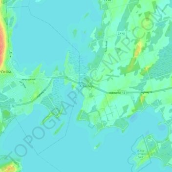
Name: Atherley topographic map, elevation, terrain.
Average elevation: 220 m
Minimum elevation: 214 m
Maximum elevation: 256 m
Other topographic maps
Click on a map to view its topography, its elevation and its terrain.
Brechin
Canada > Ontario > Simcoe County > Ramara Township
Brechin, Ramara Township, Simcoe County, Central Ontario, Ontario, L0K 1B0, Canada
Average elevation: 229 m