Geolocate

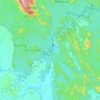
Kuala Tahan topographic maps

Click on a map to view its topography, its elevation and its terrain.

Sungai Tembeling

Malaysia > Pahang > Kuala Tahan

Average elevation: 225 m

Gear up for your next adventure:

🔋Lithium AA Batteries - Long-lasting power that performs in extreme cold
🚑Survival Whistle - Signal for help across long distances in mountains
🛌Insulated Sleeping Pad - Critical thermal barrier between you and the cold ground
🥤Collapsible Travel Cup - Saves space and weight in your mess kit
🧢Beanie Hat - Keep your head warm in cold weather

As an Amazon Associate, this site earns from qualifying purchases at no extra cost to you.