
Amasya topographic map
Interactive map
Click on the map to display elevation.
About this map
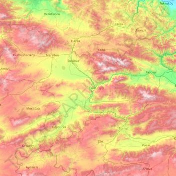
Name: Amasya topographic map, elevation, terrain.
Location: Amasya, Black Sea Region, Turkey (40.23301 34.97884 41.07760 36.51225)
Average elevation: 899 m
Minimum elevation: 4 m
Maximum elevation: 2,049 m