
Phetchabun Province topographic map
Interactive map
Click on the map to display elevation.
About this map
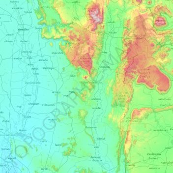
Name: Phetchabun Province topographic map, elevation, terrain.
Location: Phetchabun Province, Thailand (15.30197 100.62720 17.11722 101.79642)
Average elevation: 264 m
Minimum elevation: 16 m
Maximum elevation: 1,756 m
Other topographic maps
Click on a map to view its topography, its elevation and its terrain.
Nong Phai
Thailand > Phetchabun Province
Nong Phai, Bua Watthana, Phetchabun Province, Thailand
Average elevation: 104 m
Phetchabun
Thailand > Phetchabun Province
Phetchabun, Phetchabun Province, 67000, Thailand
Average elevation: 120 m