
Roberts County topographic map
Interactive map
Click on the map to display elevation.
About this map
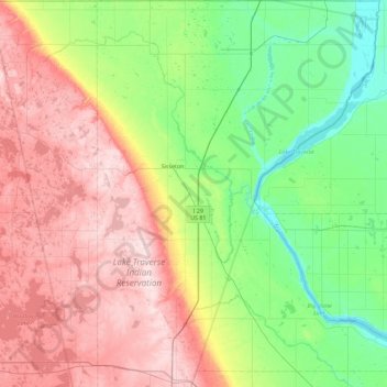
Name: Roberts County topographic map, elevation, terrain.
Location: Roberts County, South Dakota, USA (45.29917 -97.23138 45.93599 -96.47199)
Average elevation: 429 m
Minimum elevation: 293 m
Maximum elevation: 643 m
Other topographic maps
Click on a map to view its topography, its elevation and its terrain.
Missouri River
Missouri River, Sully County, South Dakota, 64072, USA
Average elevation: 901 m
Sisseton
USA > South Dakota > Sisseton
Sisseton, Roberts County, South Dakota, 57262, USA
Average elevation: 376 m
Angostura Recreation Area
Angostura Recreation Area, Fall River County, South Dakota, USA
Average elevation: 990 m