
Holmwood topographic map
Interactive map
Click on the map to display elevation.
About this map
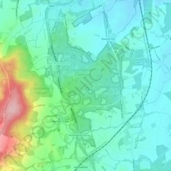
Name: Holmwood topographic map, elevation, terrain.
Average elevation: 102 m
Minimum elevation: 56 m
Maximum elevation: 247 m
Other topographic maps
Click on a map to view its topography, its elevation and its terrain.
Wotton
United Kingdom > England > Mole Valley > Wotton
Wotton, Mole Valley, Surrey, South East, England, United Kingdom
Average elevation: 135 m