
St. Joseph Island topographic map
Interactive map
Click on the map to display elevation.
About this map
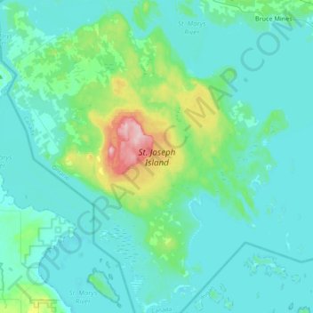
Name: St. Joseph Island topographic map, elevation, terrain.
Location: St. Joseph Island, Jocelyn, Algoma District, Ontario, Canada (46.06113 -84.11427 46.31753 -83.77301)
Average elevation: 196 m
Minimum elevation: 171 m
Maximum elevation: 348 m