
Volga River topographic map
Interactive map
Click on the map to display elevation.
About this map
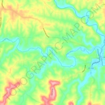
Name: Volga River topographic map, elevation, terrain.
Location: Volga River, Clayton County, Iowa, 52044, USA (42.73726 -91.36886 42.75711 -91.27009)
Average elevation: 252 m
Minimum elevation: 198 m
Maximum elevation: 342 m
Other topographic maps
Click on a map to view its topography, its elevation and its terrain.
Yellow River State Forest
Yellow River State Forest, Firetower Road, Ion, Allamakee County, Iowa, USA
Average elevation: 275 m
Lake Red Rock
Lake Red Rock, 146th Avenue, Cordova, Marion County, Iowa, 50138, USA
Average elevation: 248 m