
Ovalau topographic map
Interactive map
Click on the map to display elevation.
About this map
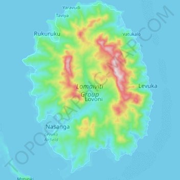
Name: Ovalau topographic map, elevation, terrain.
Location: Ovalau, Eastern, Fiji (-17.74963 178.73657 -17.61812 178.83851)
Average elevation: 76 m
Minimum elevation: -2 m
Maximum elevation: 573 m
Other topographic maps
Click on a map to view its topography, its elevation and its terrain.