
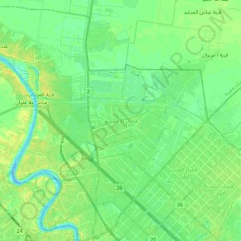
Al-Adhamiyah District topographic map
Interactive map
Click on the map to display elevation.
About this map
Name: Al-Adhamiyah District topographic map, elevation, terrain.
Average elevation: 38 m
Minimum elevation: 29 m
Maximum elevation: 49 m
Other topographic maps
Click on a map to view its topography, its elevation and its terrain.
Baghdad
Iraq > Baghdad Governorate > Baghdad
Baghdad, Al-Karkh Central Subdistrict, Al-Karkh District, Baghdad Governorate, 10001, Iraq
Average elevation: 36 m
Adhamiyah
Iraq > Baghdad Governorate > Baghdad
Adhamiyah, Al-Adhamiyah Central Subdistrict, Al-Adhamiyah District, Baghdad, Al-Adhamiyah Municipality, Baghdad Governorate, Iraq
Average elevation: 38 m