
Lubomierz topographic map
Interactive map
Click on the map to display elevation.
About this map
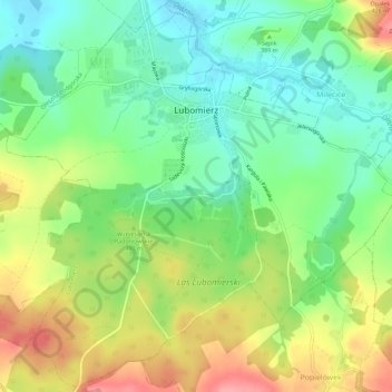
Name: Lubomierz topographic map, elevation, terrain.
Average elevation: 382 m
Minimum elevation: 342 m
Maximum elevation: 440 m
Other topographic maps
Click on a map to view its topography, its elevation and its terrain.
Kamień
Poland > Lower Silesian Voivodeship > Lwówek Śląski County
Kamień, gmina Mirsk, Lwówek Śląski County, Lower Silesian Voivodeship, Poland
Average elevation: 388 m