
ニセコ町 topographic map
Interactive map
Click on the map to display elevation.
About this map
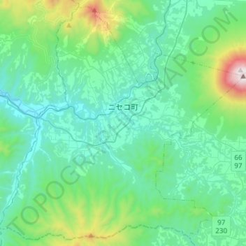
Name: ニセコ町 topographic map, elevation, terrain.
Location: ニセコ町, 虻田郡, 後志総合振興局, Préfecture de Hokkaidō, Japon (42.70718 140.56232 42.87802 140.80684)
Average elevation: 339 m
Minimum elevation: 24 m
Maximum elevation: 1,854 m