
Mbhashe Local Municipality topographic map
Interactive map
Click on the map to display elevation.
About this map
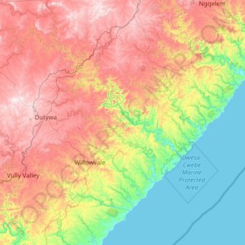
Name: Mbhashe Local Municipality topographic map, elevation, terrain.
Average elevation: 425 m
Minimum elevation: 0 m
Maximum elevation: 1,115 m
Other topographic maps
Click on a map to view its topography, its elevation and its terrain.
Alice
South Africa > Eastern Cape > Amathole District Municipality > Nkonkobe Local Municipality > Alice
Alice, Nkonkobe Local Municipality, Amathole District Municipality, Eastern Cape, 5700, South Africa
Average elevation: 586 m