
Folkestone and Hythe topographic map
Interactive map
Click on the map to display elevation.
About this map
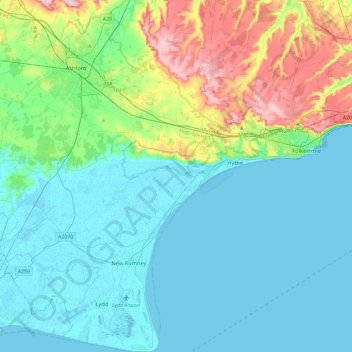
Name: Folkestone and Hythe topographic map, elevation, terrain.
Location: Folkestone and Hythe, Kent, South East, England, United Kingdom (50.91048 0.77684 51.20500 1.22124)
Average elevation: 40 m
Minimum elevation: -2 m
Maximum elevation: 191 m