
Salford topographic map
Interactive map
Click on the map to display elevation.
About this map
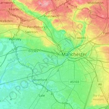
Name: Salford topographic map, elevation, terrain.
Average elevation: 52 m
Minimum elevation: 11 m
Maximum elevation: 137 m
Other topographic maps
Click on a map to view its topography, its elevation and its terrain.
Worsley
United Kingdom > England > Salford
Worsley, Salford, Greater Manchester, England, M28 2GE, United Kingdom
Average elevation: 49 m