
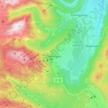
Les Angles topographic map
Interactive map
Click on the map to display elevation.
About this map
Name: Les Angles topographic map, elevation, terrain.
Average elevation: 1,819 m
Minimum elevation: 1,429 m
Maximum elevation: 2,472 m
Other topographic maps
Click on a map to view its topography, its elevation and its terrain.
Les Angles
France > Occitania > Les Angles
Les Angles, Argelès-Gazost, Hautespyrenees, Occitania, Metropolitan France, 65100, France
Average elevation: 529 m