
Ribble Valley topographic map
Interactive map
Click on the map to display elevation.
About this map
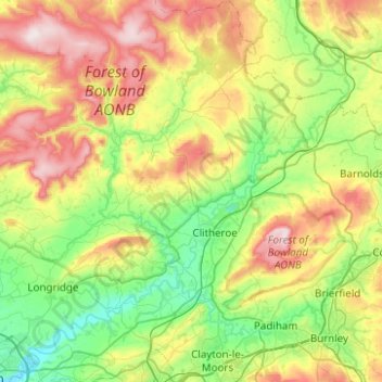
Name: Ribble Valley topographic map, elevation, terrain.
Average elevation: 200 m
Minimum elevation: 10 m
Maximum elevation: 561 m
Other topographic maps
Click on a map to view its topography, its elevation and its terrain.
Whalley
United Kingdom > England > Ribble Valley > Whalley
Whalley, Ribble Valley, Lancashire, North West England, England, United Kingdom
Average elevation: 109 m