
D-2 topographic map
Interactive map
Click on the map to display elevation.
About this map
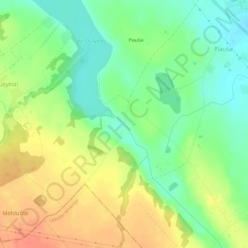
Name: D-2 topographic map, elevation, terrain.
Average elevation: 125 m
Minimum elevation: 99 m
Maximum elevation: 157 m
Other topographic maps
Click on a map to view its topography, its elevation and its terrain.
Burbiškis
Lithuania > Utena County > Anykščiai Eldership
Burbiškis, Anykščiai Eldership, Anykščių rajono savivaldybė, Utena County, 29211, Lithuania
Average elevation: 139 m