
Galgenberg topographic map
Interactive map
Click on the map to display elevation.
About this map
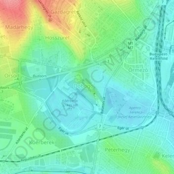
Name: Galgenberg topographic map, elevation, terrain.
Location: Galgenberg, XI. Bezirk, Budapest, Mittelungarn, Ungarn (47.45428 18.99758 47.46251 19.00855)
Average elevation: 130 m
Minimum elevation: 104 m
Maximum elevation: 196 m
Other topographic maps
Click on a map to view its topography, its elevation and its terrain.
Gellértberg
Gellértberg, Budapest, XI. Bezirk, Mittelungarn, 1114, Ungarn
Average elevation: 126 m
Gottesberg
Gottesberg, XII. Bezirk, Budapest, XII. Bezirk, Mittelungarn, 1125, Ungarn
Average elevation: 247 m
Johannisberg
Johannisberg, XII. Bezirk, Budapest, Mittelungarn, 1021, Ungarn
Average elevation: 343 m
Johannisberg
Johannisberg, XII. Bezirk, Budapest, Mittelungarn, Ungarn
Average elevation: 333 m