
Sturgeon Falls topographic map
Interactive map
Click on the map to display elevation.
About this map
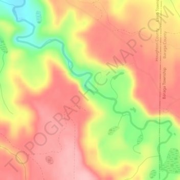
Name: Sturgeon Falls topographic map, elevation, terrain.
Average elevation: 328 m
Minimum elevation: 240 m
Maximum elevation: 381 m
Other topographic maps
Click on a map to view its topography, its elevation and its terrain.
Houghton
United States > Michigan > Houghton County
Houghton, Houghton County, Michigan, 49931, United States
Average elevation: 269 m
Hurontown
United States > Michigan > Houghton County
Hurontown, Portage Township, Houghton County, Michigan, 49931, United States
Average elevation: 260 m