
Palanpur Taluka topographic map
Interactive map
Click on the map to display elevation.
About this map
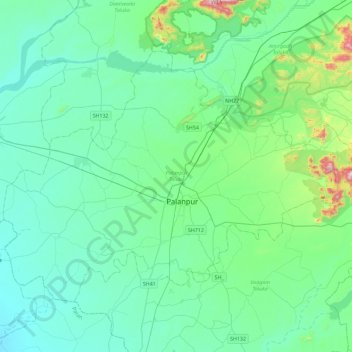
Name: Palanpur Taluka topographic map, elevation, terrain.
Location: Palanpur Taluka, Banas Kantha District, Gujarat, India (24.05270 72.20567 24.34764 72.66001)
Average elevation: 207 m
Minimum elevation: 103 m
Maximum elevation: 779 m
Other topographic maps
Click on a map to view its topography, its elevation and its terrain.
Palanpur
India > Gujarat > Palanpur Taluka > Palanpur
Palanpur, Palanpur Taluka, Banas Kantha District, Gujarat, 385001, India
Average elevation: 218 m