
St Catherines topographic map
Interactive map
Click on the map to display elevation.
About this map
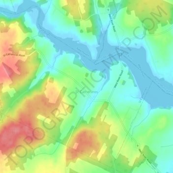
Name: St Catherines topographic map, elevation, terrain.
Location: St Catherines, Queens County, Prince Edward Island, Canada (46.17568 -63.33059 46.21050 -63.27700)
Average elevation: 33 m
Minimum elevation: -3 m
Maximum elevation: 88 m