
Rolling River topographic map
Interactive map
Click on the map to display elevation.
About this map
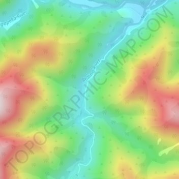
Name: Rolling River topographic map, elevation, terrain.
Location: Rolling River, Tasman, New Zealand (-41.46756 172.56639 -41.44312 172.58103)
Average elevation: 539 m
Minimum elevation: 281 m
Maximum elevation: 925 m
Other topographic maps
Click on a map to view its topography, its elevation and its terrain.