
Lanark topographic map
Interactive map
Click on the map to display elevation.
About this map
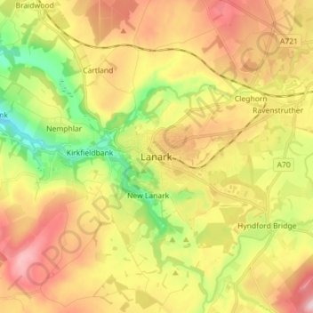
Name: Lanark topographic map, elevation, terrain.
Location: Lanark, South Lanarkshire, Scotland, ML11 7EX, United Kingdom (55.63363 -3.81804 55.71363 -3.73804)
Average elevation: 206 m
Minimum elevation: 67 m
Maximum elevation: 349 m
Other topographic maps
Click on a map to view its topography, its elevation and its terrain.
Bothwell
United Kingdom > Scotland > South Lanarkshire
Bothwell, South Lanarkshire, Scotland, G71 8RB, United Kingdom
Average elevation: 65 m
Biggar
United Kingdom > Scotland > South Lanarkshire
Biggar, South Lanarkshire, Scotland, ML12 6AE, United Kingdom
Average elevation: 254 m
East Kilbride
United Kingdom > Scotland > South Lanarkshire
East Kilbride, South Lanarkshire, Scotland, G74 1JT, United Kingdom
Average elevation: 175 m