
Datça topographic map
Interactive map
Click on the map to display elevation.
About this map
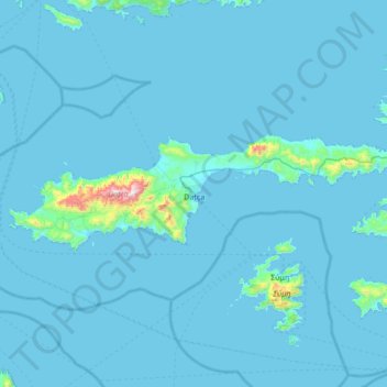
Name: Datça topographic map, elevation, terrain.
Location: Datça, Muğla, Aegean Region, 48900, Turkey (36.64735 27.36148 36.81332 28.04083)
Average elevation: 31 m
Minimum elevation: -2 m
Maximum elevation: 1,128 m
Other topographic maps
Click on a map to view its topography, its elevation and its terrain.