
Amsterdam topographic map
Interactive map
Click on the map to display elevation.
About this map
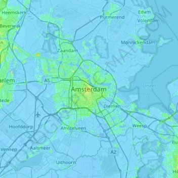
Name: Amsterdam topographic map, elevation, terrain.
Location: Amsterdam, North Holland, Netherlands, 1012JS, Netherlands (52.21276 4.73360 52.53276 5.05360)
Average elevation: -1 m
Minimum elevation: -8 m
Maximum elevation: 18 m
Other topographic maps
Click on a map to view its topography, its elevation and its terrain.
Schellingwoude
Netherlands > North Holland > Amsterdam
Schellingwoude, Amsterdam, North Holland, Netherlands, 1023 NH, Netherlands
Average elevation: 1 m
Vondelpark
Netherlands > North Holland > Amsterdam
Vondelpark, Amsterdam, North Holland, Netherlands
Average elevation: 5 m