
Nea Silata topographic map
Interactive map
Click on the map to display elevation.
About this map
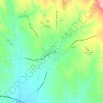
Name: Nea Silata topographic map, elevation, terrain.
Average elevation: 74 m
Minimum elevation: 12 m
Maximum elevation: 194 m
Other topographic maps
Click on a map to view its topography, its elevation and its terrain.
Agios Isidoros
Greece > Macedonia and Thrace > Chalkidiki Regional Unit > Sithonia Municipal Unit
Agios Isidoros, Sithonia Municipal Unit, Municipality of Sithonia, Chalkidiki Regional Unit, Central Macedonia, Macedonia and Thrace, Greece
Average elevation: 113 m