
Frankford topographic map
Interactive map
Click on the map to display elevation.
About this map
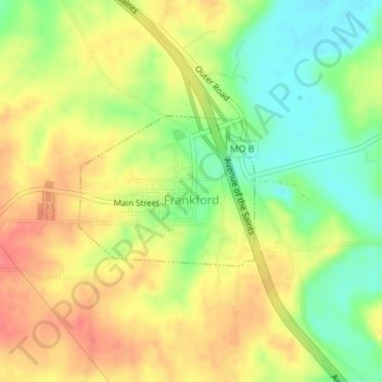
Name: Frankford topographic map, elevation, terrain.
Location: Frankford, Pike County, Missouri, United States (39.48833 -91.32959 39.49896 -91.31347)
Average elevation: 185 m
Minimum elevation: 151 m
Maximum elevation: 214 m
Other topographic maps
Click on a map to view its topography, its elevation and its terrain.
Ted Shanks Conservation Area
United States > Missouri > Pike County
Ted Shanks Conservation Area, Pike County, Missouri, 63433, United States
Average elevation: 144 m