
Rocky Inlet topographic map
Interactive map
Click on the map to display elevation.
About this map
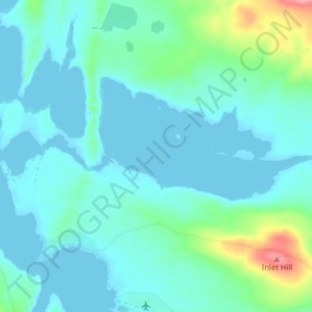
Name: Rocky Inlet topographic map, elevation, terrain.
Location: Rocky Inlet, Falkland Islands (-51.70103 -60.09429 -51.69768 -60.02598)
Average elevation: 17 m
Minimum elevation: -4 m
Maximum elevation: 101 m
Other topographic maps
Click on a map to view its topography, its elevation and its terrain.