
Río Gallegos topographic map
Interactive map
Click on the map to display elevation.
About this map
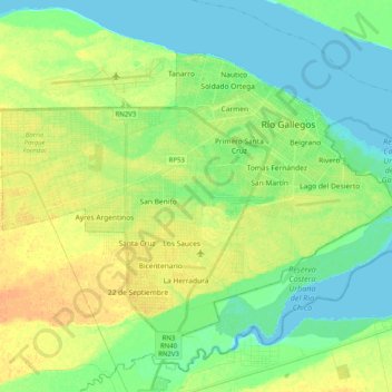
Name: Río Gallegos topographic map, elevation, terrain.
Location: Río Gallegos, Güer Aike, Santa Cruz Province, Argentina (-51.69246 -69.36360 -51.60031 -69.16158)
Average elevation: 9 m
Minimum elevation: 0 m
Maximum elevation: 26 m