
Delabole topographic map
Interactive map
Click on the map to display elevation.
About this map
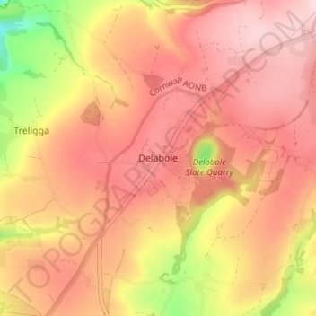
Name: Delabole topographic map, elevation, terrain.
Average elevation: 177 m
Minimum elevation: 12 m
Maximum elevation: 262 m
Other topographic maps
Click on a map to view its topography, its elevation and its terrain.
Bowithick
United Kingdom > England > Delabole > Trewarmett
Bowithick, Delabole, Cornwall, South West England, England, PL33 9DE, United Kingdom
Average elevation: 200 m