
Thane topographic map
Interactive map
Click on the map to display elevation.
About this map
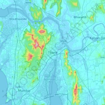
Name: Thane topographic map, elevation, terrain.
Average elevation: 30 m
Minimum elevation: -3 m
Maximum elevation: 477 m
Other topographic maps
Click on a map to view its topography, its elevation and its terrain.
Pachwad
India > Maharashtra > Thane > Thane
Pachwad, Thane, Maharashtra, 400615, India
Average elevation: 87 m