
Beauharnois topographic map
Interactive map
Click on the map to display elevation.
About this map
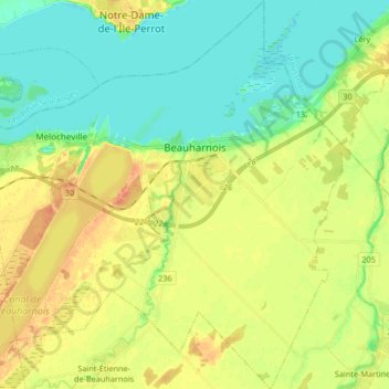
Name: Beauharnois topographic map, elevation, terrain.
Average elevation: 34 m
Minimum elevation: 18 m
Maximum elevation: 55 m
Other topographic maps
Click on a map to view its topography, its elevation and its terrain.
Salaberry-de-Valleyfield
Canada > Quebec > Beauharnois-Salaberry
Salaberry-de-Valleyfield, Beauharnois-Salaberry, Montérégie, Quebec, Canada
Average elevation: 47 m