
Maquapit Lake topographic map
Interactive map
Click on the map to display elevation.
About this map
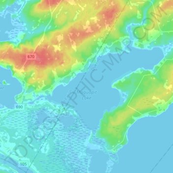
Name: Maquapit Lake topographic map, elevation, terrain.
Average elevation: 12 m
Minimum elevation: -4 m
Maximum elevation: 58 m
Other topographic maps
Click on a map to view its topography, its elevation and its terrain.
Princess Park
Canada > New Brunswick > Canning Parish
Princess Park, Canning Parish, Queens County, New Brunswick, E4B 1Y7, Canada
Average elevation: 7 m