
Goudhurst topographic map
Interactive map
Click on the map to display elevation.
About this map
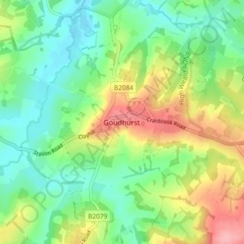
Name: Goudhurst topographic map, elevation, terrain.
Location: Goudhurst, Kent, South East, England, TN17 1BN, United Kingdom (51.09339 0.44393 51.13339 0.48393)
Average elevation: 66 m
Minimum elevation: 26 m
Maximum elevation: 136 m