
Norway Lake topographic map
Interactive map
Click on the map to display elevation.
About this map
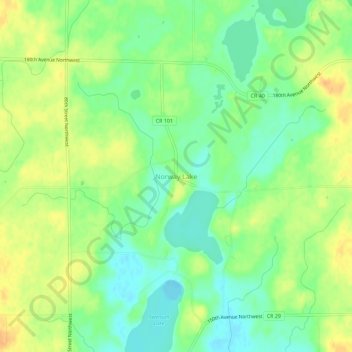
Name: Norway Lake topographic map, elevation, terrain.
Location: Norway Lake, Kandiyohi County, Minnesota, United States (45.26357 -95.15502 45.30357 -95.11502)
Average elevation: 371 m
Minimum elevation: 355 m
Maximum elevation: 388 m