
Nangang District topographic map
Interactive map
Click on the map to display elevation.
About this map
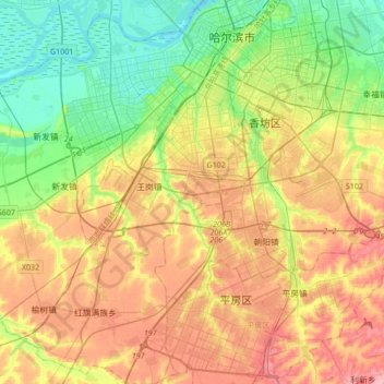
Name: Nangang District topographic map, elevation, terrain.
Location: Nangang District, Harbin, Heilongjiang, 150000, China (45.54274 126.43256 45.78166 126.71572)
Average elevation: 158 m
Minimum elevation: 113 m
Maximum elevation: 215 m
Other topographic maps
Click on a map to view its topography, its elevation and its terrain.