
Yeonhui-dong topographic map
Interactive map
Click on the map to display elevation.
About this map
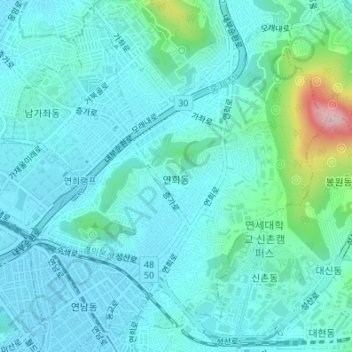
Name: Yeonhui-dong topographic map, elevation, terrain.
Location: Yeonhui-dong, Seodaemun-gu, Seoul, South Korea (37.56088 126.91681 37.58424 126.94569)
Average elevation: 56 m
Minimum elevation: 14 m
Maximum elevation: 281 m