
Chester Grant topographic map
Interactive map
Click on the map to display elevation.
About this map
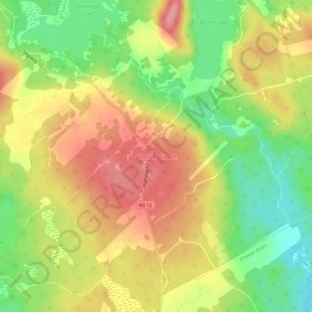
Name: Chester Grant topographic map, elevation, terrain.
Location: Chester Grant, Lunenburg County, Nova Scotia, Canada (44.59076 -64.33980 44.63076 -64.29980)
Average elevation: 67 m
Minimum elevation: 11 m
Maximum elevation: 118 m