
Penobsquis topographic map
Interactive map
Click on the map to display elevation.
About this map
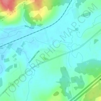
Name: Penobsquis topographic map, elevation, terrain.
Average elevation: 39 m
Minimum elevation: 20 m
Maximum elevation: 108 m
Other topographic maps
Click on a map to view its topography, its elevation and its terrain.
Anagance
Canada > New Brunswick > Cardwell Parish
Anagance, Cardwell Parish, Kings County, New Brunswick, Canada
Average elevation: 55 m