
Kilosa topographic map
Interactive map
Click on the map to display elevation.
About this map
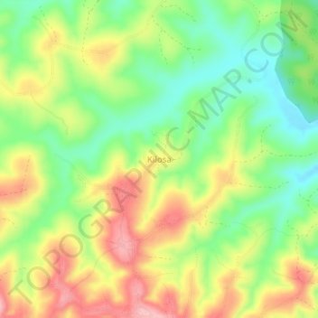
Name: Kilosa topographic map, elevation, terrain.
Location: Kilosa, Mufindi, Iringa, Southern Highlands Zone, Tanzania (-8.48817 35.60148 -8.44817 35.64148)
Average elevation: 1,613 m
Minimum elevation: 1,542 m
Maximum elevation: 1,698 m