
Miminegash topographic map
Interactive map
Click on the map to display elevation.
About this map
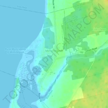
Name: Miminegash topographic map, elevation, terrain.
Average elevation: 6 m
Minimum elevation: -3 m
Maximum elevation: 20 m
Other topographic maps
Click on a map to view its topography, its elevation and its terrain.
Miminegash
Canada > Prince Edward Island > Miminegash
Miminegash, Rural Municipality of Miminegash, Prince County, Prince Edward Island, C0B 1S0, Canada
Average elevation: 6 m