
Walter E Long Lake topographic map
Interactive map
Click on the map to display elevation.
About this map
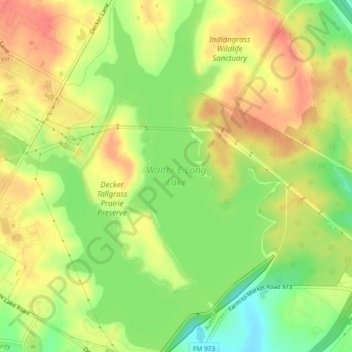
Name: Walter E Long Lake topographic map, elevation, terrain.
Average elevation: 176 m
Minimum elevation: 143 m
Maximum elevation: 201 m
Other topographic maps
Click on a map to view its topography, its elevation and its terrain.
Mueller Lake
United States > Texas > Austin
Mueller Lake, Mueller, Austin, Travis County, Texas, United States
Average elevation: 185 m
Sunset Valley
United States > Texas > Austin > Sunset Valley
Sunset Valley, Austin, Travis County, Texas, 78745, United States
Average elevation: 208 m