Ostrowiec topographic map
Interactive map
Click on the map to display elevation.
About this map
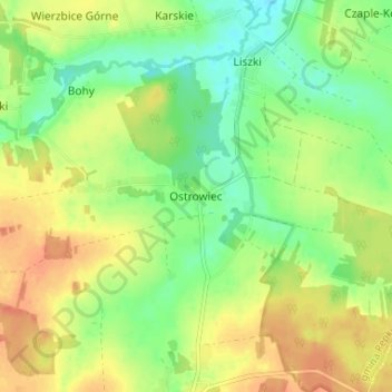
Name: Ostrowiec topographic map, elevation, terrain.
Average elevation: 145 m
Minimum elevation: 125 m
Maximum elevation: 165 m

Click on the map to display elevation.
Name: Ostrowiec topographic map, elevation, terrain.
Average elevation: 145 m
Minimum elevation: 125 m
Maximum elevation: 165 m