
Orchard Hills topographic map
Interactive map
Click on the map to display elevation.
About this map
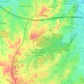
Name: Orchard Hills topographic map, elevation, terrain.
Average elevation: 56 m
Minimum elevation: 19 m
Maximum elevation: 104 m
Other topographic maps
Click on a map to view its topography, its elevation and its terrain.
Sydney International Regatta Centre
Australia > New South Wales > Sydney > Penrith > Upper Castlereagh
Sydney International Regatta Centre, Upper Castlereagh, Castlereagh, Penrith, Sydney, Penrith City Council, New South Wales, 2749, Australia
Average elevation: 19 m